
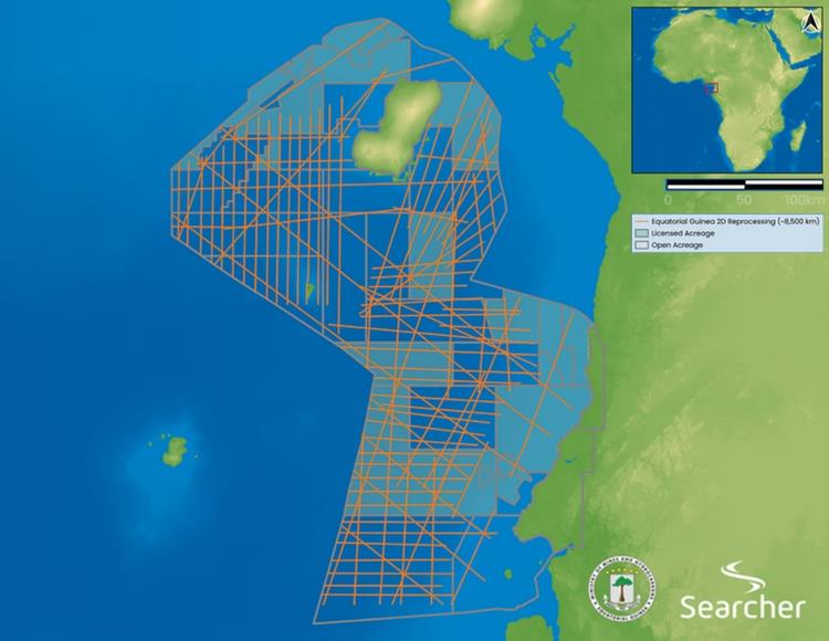
Searcher, a leading provider of global geoscience data solutions, has announced the launch of a major seismic reprocessing initiative covering 8,500 km of offshore data in Equatorial Guinea. The project aims to deliver the highest-resolution imaging of the country’s offshore basins ahead of the EG Ronda 2026 licensing round, with fast-track results available immediately and final deliverables scheduled for release before the round opens in April 2026.
Using the latest broadband Pre-Stack Depth Migration (PSDM) and Full Waveform Inversion (FWI) techniques, the reprocessing will transform legacy datasets into a new, high-definition view of the subsurface - bringing unprecedented clarity to Equatorial Guinea’s offshore basins and revealing untapped exploration potential.
Equatorial Guinea is entering a pivotal phase in its energy future. With the government preparing to offer up to 24 blocks in the upcoming licensing round, high-quality seismic imaging is essential for confident decision-making. By delivering reprocessed data with enhanced structural and stratigraphic resolution, Searcher is helping de-risk exploration efforts and attract new investment to the country’s offshore domain.
'This project is about more than reprocessing data - it’s about delivering actionable insight,' said Alan Hopping, Managing Director of Searcher. 'By combining cutting-edge imaging with fast-track delivery, we’re giving explorers a head start and helping Equatorial Guinea showcase the true potential of its offshore basins.'
The initiative aligns with the Ministry of Mines and Hydrocarbons’ goal of revitalising the energy sector and stimulating new exploration activity. With results available ahead of the licensing round, Searcher’s work provides a powerful foundation for evaluating opportunities and unlocking the next phase of offshore discovery.
Source: Searcher