Viridien has announced the launch of Phase 1 of its major legacy 3D seismic reimaging project offshore Guyana. This high-end imaging program has received strong industry backing, with early-out results expected in the first quarter of 2027.
The project covers more than 10,000 square kilometres of existing 3D seismic data from four major surveys: Kaieteur, Georgetown, Kanuku, and Corentyne. The strategic objective of this initiative is to provide much clearer subsurface visibility in areas located updip of the highly prolific Stabroek Block, as well as across Guyana's open, shallow-water blocks.
By applying its latest proprietary reprocessing workflows, Viridien will merge these legacy surveys with newly acquired 3D data. This will eventually create a seamless, continuous regional dataset stretching across more than 14,000 square kilometres, allowing explorers to better evaluate emerging oil and gas plays and prepare for future offshore licensing rounds.
Viridien holds the exclusive access and commercialization rights to these valuable legacy datasets. For further details on the project, inquiries can be directed to the Earth Data team at datalibrary.nala@viridiengroup.com.
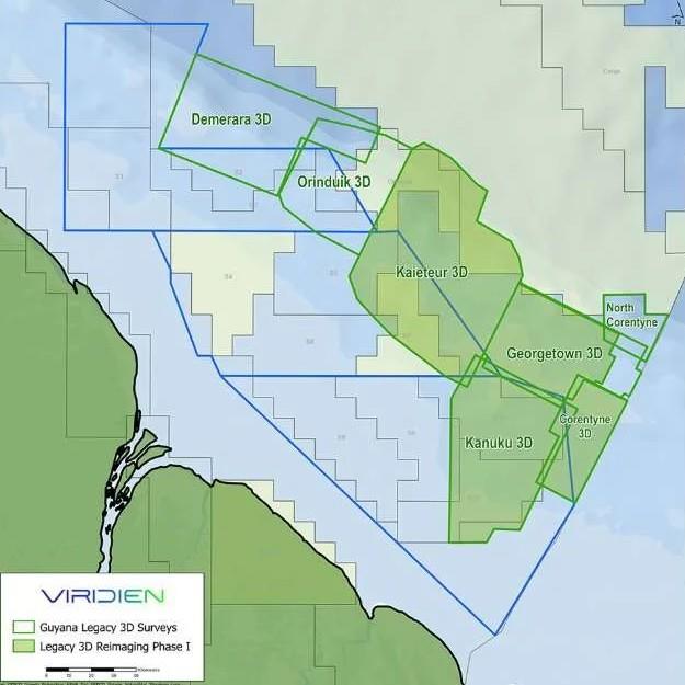
Source: Viridien