
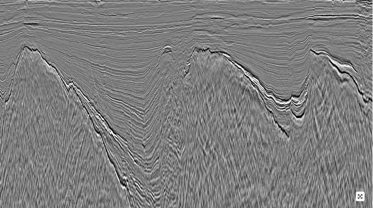
PGS has announced that final imaging products are now available on the first phase of the Sarawak MultiClient project, enabling AVO analysis of prospects and leads using 8,400 sq km of broadband depth data.
Phase 1 of the Sarawak MultiClient program was carried out by the consortium of PGS, TGS and SLB.
The data targets the proven Tatua Grabens and West Luconia province of Sarawak, an area that consists of Tertiary clastic and carbonate targets, which is part of the greater northwest Borneo Sundaland geological province.
This is the first phase of a multi-year contract. Phase 2 (currently in processing) will add 13,100 sq km of new and rejuvenated data, while Phase 3, which is now in acquisition, will expand coverage with a further 5,300 sq km of broadband data.
The Sabah-Sarawak seismic consortium has a multi-year license to acquire and process up to 105,000 sq km of MultiClient 3D data over a 5-year period in the Sarawak Basin.
Source: PGS