The Norwegian Offshore Directorate has launched an interactive map, Deep Sea Surveys.
It provides an overview of mapping and sampling carried out in the deep sea on the Norwegian continental shelf (NCS).
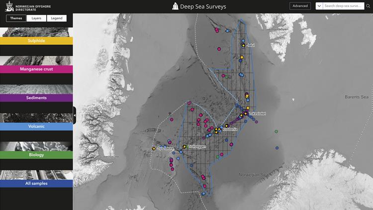
The data is published under the Norwegian Licence for Open Government Data (NLOD).
Source: Norwegian Offshore Directorate