TGS, a leading global provider of energy data and intelligence, has announced the signing of an agreement with the Petroleum Commission, Ghana, to create a new offshore 2D-cubed project across the Keta Basin, offshore Ghana, giving explorers a single, unified subsurface view of one of Africa’s most promising underexplored margins.
Phase 1 of the Gulf of Guinea 2D-cubed will use 5,500 sq km of 3D data and over 14,700 km of 2D data from multiple surveys as input to create a 25,300 sq km 2D-cubed project spanning both the shelf and deepwater areas of the Keta Basin, offshore Ghana.
TGS’ 2D-cubed technology generates a single, structural conformable 3D seismic volume from existing multi-vintage 2D and 3D data, using an advanced interpolation workflow to fill the gaps between lines and suppress legacy migration artifacts. The result is a continuous, modern-quality 3D dataset that will provide valuable insight to explorers and support opportunity screening across the area.
For companies evaluating the Keta Basin – home to one of the largest underexplored deepwater fan systems in Africa – this unified volume removes the burden of stitching together disparate legacy surveys. It gives licensing and exploration teams a coherent, basin-wide picture to high-grade leads and mature prospects, and to make faster, more confident decisions ahead of increasing exploration and licensing activity, without waiting for new 3D data to be shot.
'The Keta Basin holds real untapped potential, and our customers need a clear, reliable view of it to act with confidence,' said David Hajosky, Executive Vice President, Multi-Client at TGS. 'By bringing decades of 2D and 3D data together into a single 2D-cubed volume, we are giving explorers a ready-to-use foundation for prospect maturation, reflecting TGS’ continued commitment to delivering high-quality seismic data that identifies new resource potential and supports increasing exploration activity across the Transform Margin of West Africa.'
Final products are expected in Q1 2027.
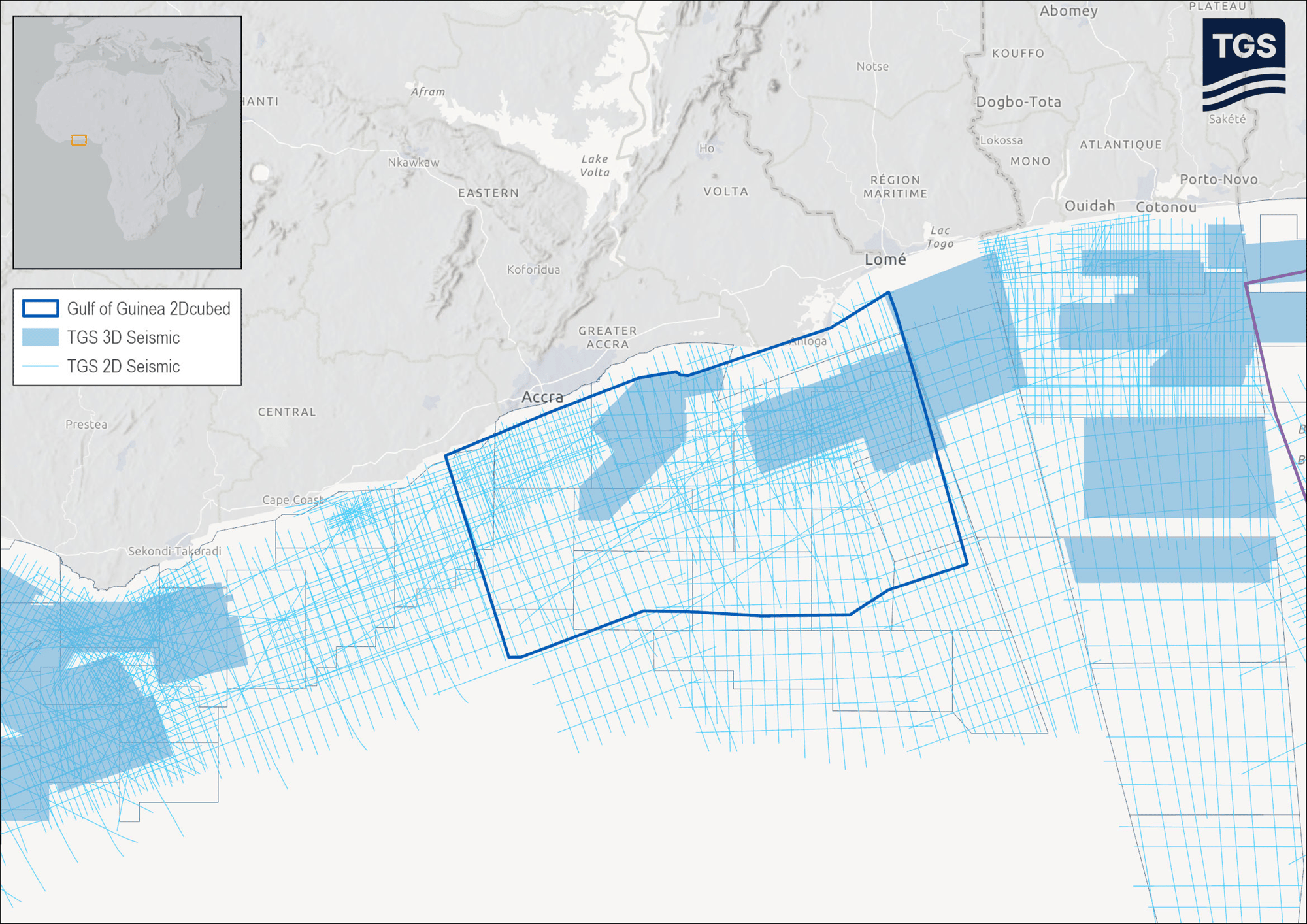
Phase 1 of the Gulf of Guinea 2D-cubed will use 5,500 sq km of 3D data and over 14,700 km of 2D data from multiple surveys as input to create a 25,300 sq km 2D-cubed project.
Source: TGS